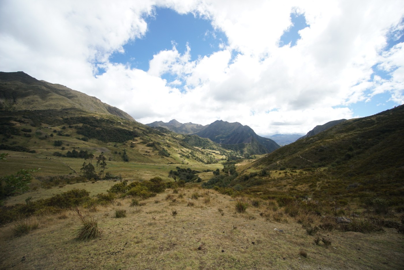
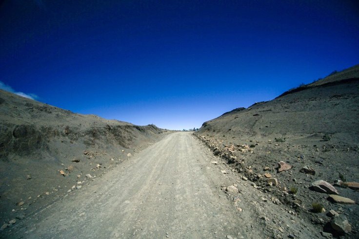
We have made our way back into the mountains following jeep tracks that criss cross the country side. Any direction we wanted to go, including going back to the main highway, would require us to summit a mountain. The road to Chita was our hardest day by far with no exception. It wasn’t the most elevation we had done nor was it the furthest we have pedaled, but it was the most grueling. The wind was fierce, and forced its way head on into us for hours on end. Wind so strong that pushing the bikes was a futile, an exercise in expending all your energy.
We spent all day battling the ups and downs of difficult terrain, the wind gusts, the switchbacks. An extra rest day in Chita recovering was warranted. We hoped our next challenge would not be quite as difficult, however on paper we were not sure what to expect.
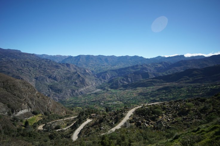
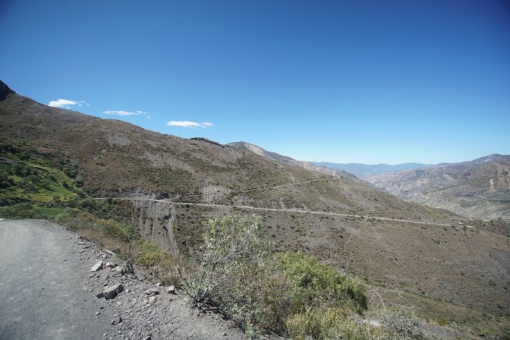
The dirt road between Chita and Cocuy rises to over 4,100 metres above sea level. This was a massive obstacle.
Earlier in the week we had met a couple of cyclists doing our route in reverse. They had summited this 4,100m pass without much trouble. Their lightweight gear and bikes making quick work of the climbs. Olivia and I were a bit skeptical. We had never been that high before, we weren’t sure how our bodies would react. Would we be able to pedal at that altitude? Are we acclimatized enough?
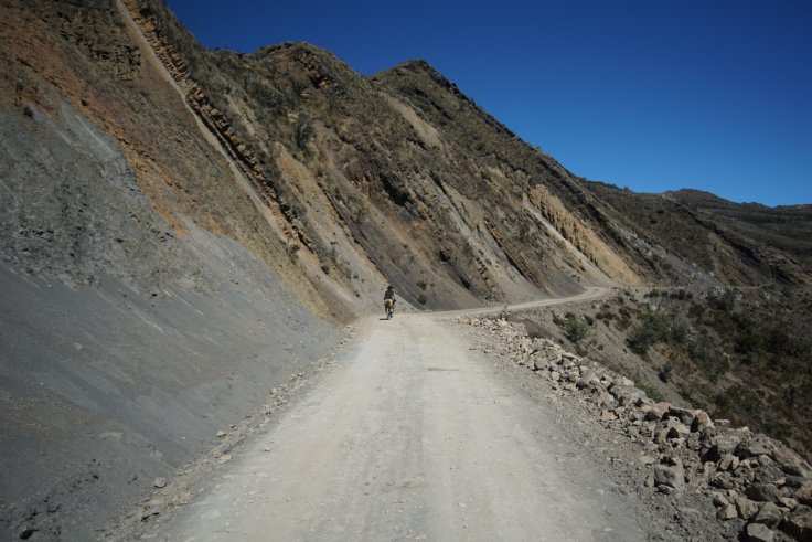
The road or of Chita dips down to 2,900m so we’re able to get some distance under our belt to start the day. Then the climbing begins. Up, up, up, for kilometers on end. Before all is said and done we have to gain over 1,250m of vertical elevation before we start to descend. This can be slightly depressing when you know the next 20kms are all uphill and you’ll only be able to go downhill after a day or more of work.
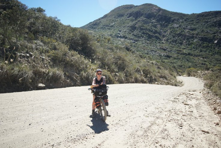
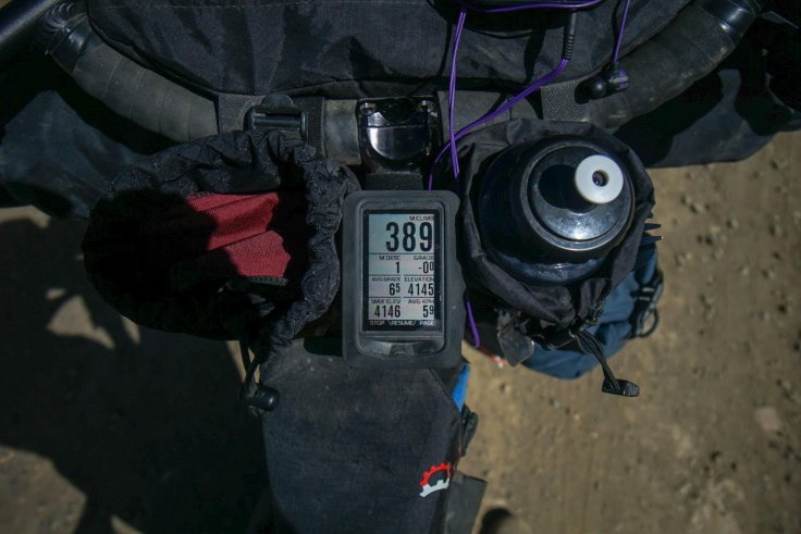
On ascents like this I don’t look at distance on my bike computer, I look at meters climbed. Just get into a good pace of knocking down 100m, then 200m. At 400m down we have a quick lunch. By 600m Olivia isn’t feeling well. Our elevation is about 3,400m. She feels lightheaded and has to push her bike even though the terrain is gradual enough to bike. I don’t feel the effects yet but soon enough I won’t be feeling well either.
I worry about Olivia passing out and hitting her head and our lack of resources if we have to walk the rest of the way. We are carrying extra food and water but only enough for two days. I have no idea how long walking up this mountain pass would take us but I’m betting it’s longer than two days. After talking it through we decide to press on and monitor the situation. A couple hundred metres later Olivia feels better, but I’m starting to feel worse.
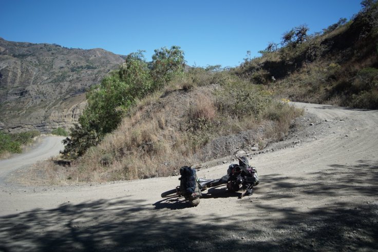
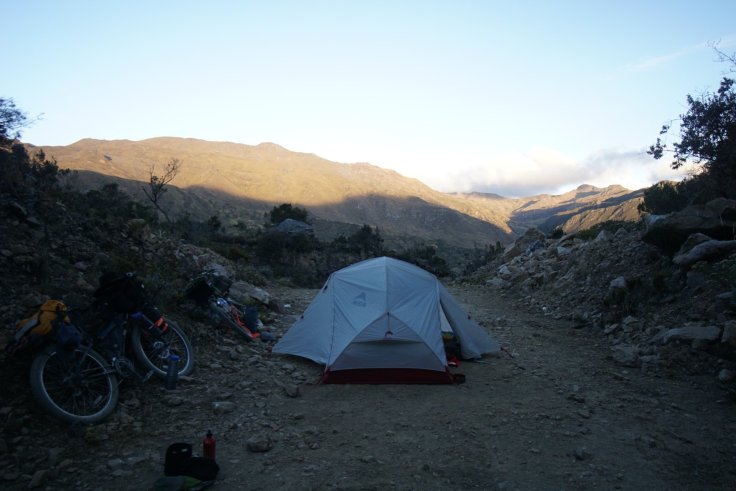
We reach 800m climbing on the day and that brings us to 3,700m. We find a mined out portion of the mountain side that crews likely used to park construction equipment while building the road. It goes back 15 metres so we are nice and hidden from any passers by. I feel lightheaded so I’m happy we have found a place to stop for the day. I had wanted to go further so we had less climbing to do on the second day, but that’s not going to happen now.
Every movement takes concentration, and I don’t have a lot of concentration to give. I don’t have the energy to blow up my air mattress, Olivia helps me with that. We have a quick dinner that I hardly eat, I don’t have an appetite. We’re in bed under the stars at 7pm.
The next morning I’m feeling better but still a long way from 100%. Olivia’s feeling good and we make a quick granola breakfast and are on our way, climbing the remaining 400m in a couple hours.
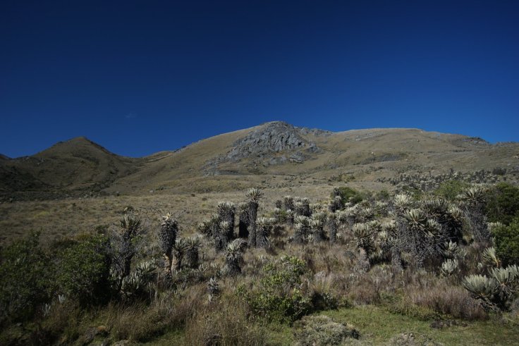
Finally we make it to 4,144 metres. The other side of the pass is distinctly different from where we had just come from. It’s brown and sandy and filled with cacti. From here it’s all downhill, 20km into Cocuy.
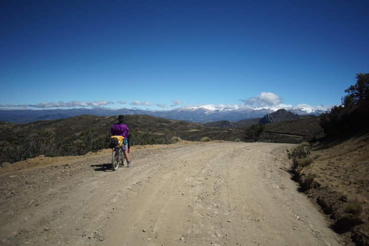
We learned a lot at altitude. How our bodies would perform and function and we know what to expect and what we need in future situations. We successfully crested 4,100m, an achievement we’re pretty proud of.

Love you guys! If anyone can faces these challenges together it’s little head and big head ❤️❤️❤️
LikeLike
❤️❤️❤️
LikeLike
Hi guys, good to bump into you at Christmas. Looks like you’re getting on well, we definitely had an easier life with just a couple of weeks worth of kit to carry. Be interested to follow the rest of your journey, we’re definitely thinking of doing similar in a different region of Colombia in the future. We completed the rest of the route to Villa De Leyva just before New Year. We decided to do that extra Paramo section in a quite challenging 2 days to avoid carrying so much extra food etc. It worked okay with some water collection from friendly local campesinos, but was a pretty tough couple of days. Good luck and have fun with the rest of your trip, sitting back at my desk i’m very jealous.
We’re on Insta: @matthancill and @cait_elliott
And strava, if you use it: https://www.strava.com/athletes/1162745
LikeLike
Thanks for connecting with us here Matt and Cait! You were the only cyclists we ran into doing the whole time! We’re in San Gil but hitting the road tomorrow. Let us know if you make it back to South America in the next year. We’ll be here! Have a great 2019!
LikeLike
Nice blog thanks for possting
LikeLike